


SANCTUARIES LA EXPLORES THE QUIETER SIDE OF LOS ANGELES THROUGH DESIGN.
ROOTED IN THE BELIEF THAT SANCTUARY EXISTS EVERYWHERE, OFTEN HIDDEN IN PLAIN SIGHT.
IF YOU ENJOY THIS PUBLICATION, CONSIDER SUBSCRIBING OR SHARING IT WITH A FRIEND.
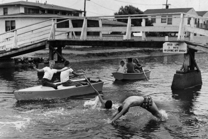
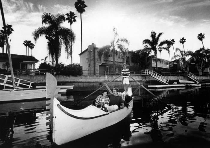
PHOTOGRAPHY COURTESY OF THE LA PUBLIC LIBRARY & VENICE HERITAGE MUSEUM
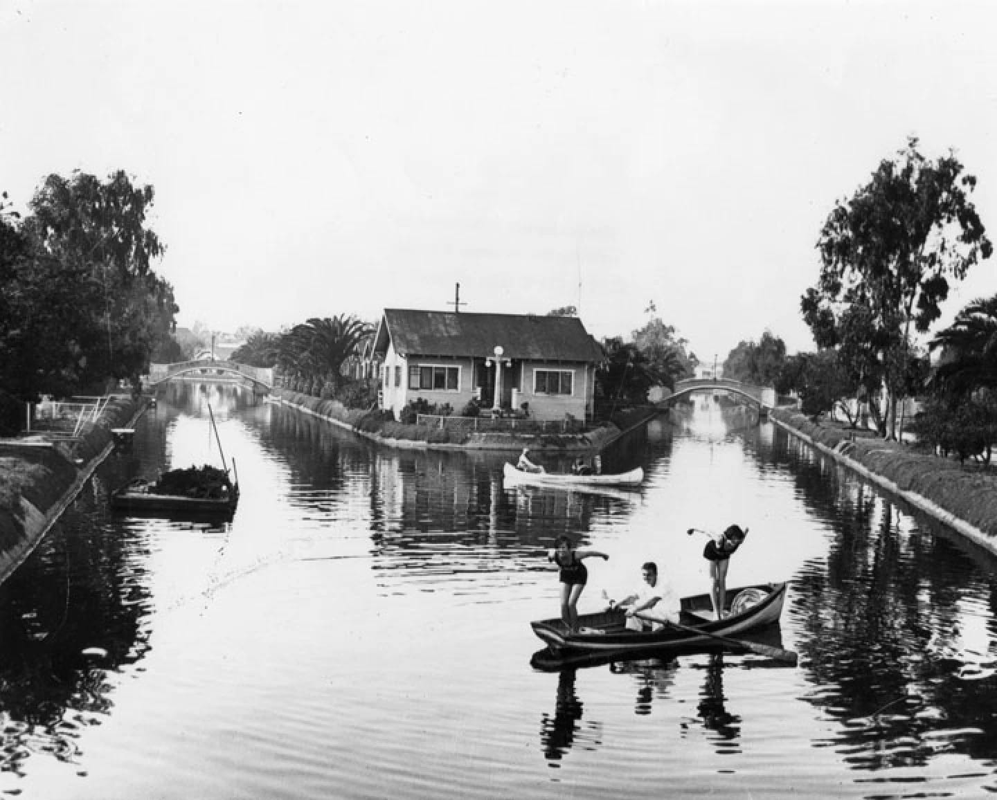
Go to Venice, stand in the middle of Windward Circle, and its shape feels bizarre for a traffic intersection; streets approach from odd angles, the Grand Boulevard curves away. Main Street dissects diagonally and Windward Avenue points toward the ocean.
When you realize these strange angles are the ghosts of canals from a century ago, converging at the old Venice Lagoon, the shapes suddenly make sense.
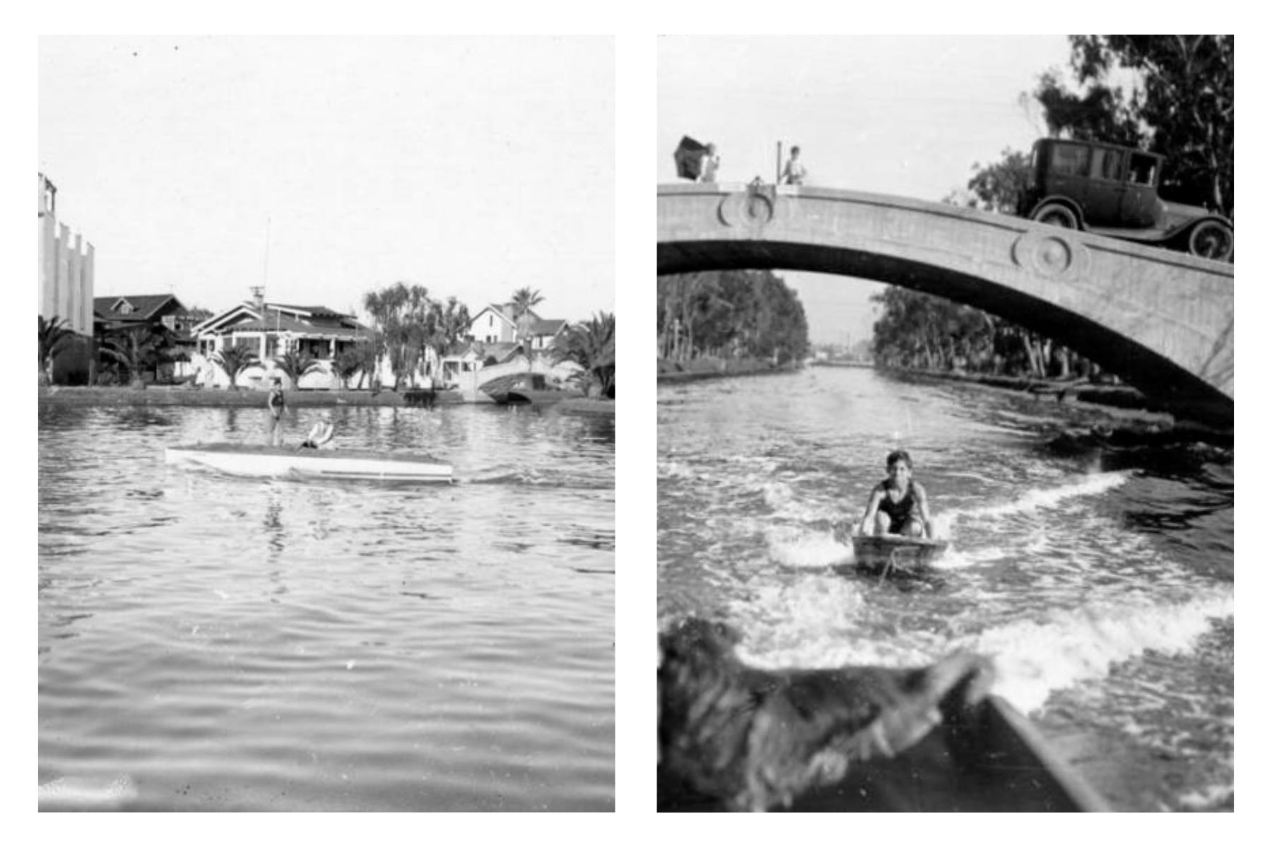
One hundred years ago Windward Circle was a central lagoon complete with gondola rides, waterfront hotels, and a slew of other tourist attractions. Much of Venice was once, true to its name, actually navigated via water.
The roads did not replace the original plan; they solidified it. Cars now drive where boats glided. Asphalt covers up the lively history that was once there.
Before it was Venice, the area was part of a much larger natural wetland complex stretching from the coast toward the Baldwin Hills. As many Angelinos know, this area is the ancestral homeland of the Tongva, Kizh, Gabrieleño people, who lived throughout the Ballona Watershed for thousands of years. The landscape was not empty land awaiting invention; it was inhabited and highly abundant tidal marshland.
By the beginning of the twentieth century, developers saw something else: land that was difficult to build on.
The developer Abbot Kinney did not bring water to an otherwise dry place; he reorganized an existing wet landscape into real estate, transportation, and theater.
Kinney — a tobacco heir — arrived in Southern California after widespread travels across Europe, Asia, and the Pacific. In 1891, he began developing land south of Santa Monica with several partners. When the partnership dissolved in 1904, the property was divided by a coin toss. Kinney received the undeveloped southern tract — a stretch of marshy coast his former partners considered the less valuable half.
He imagined a city there.
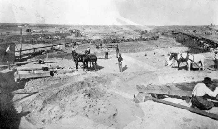
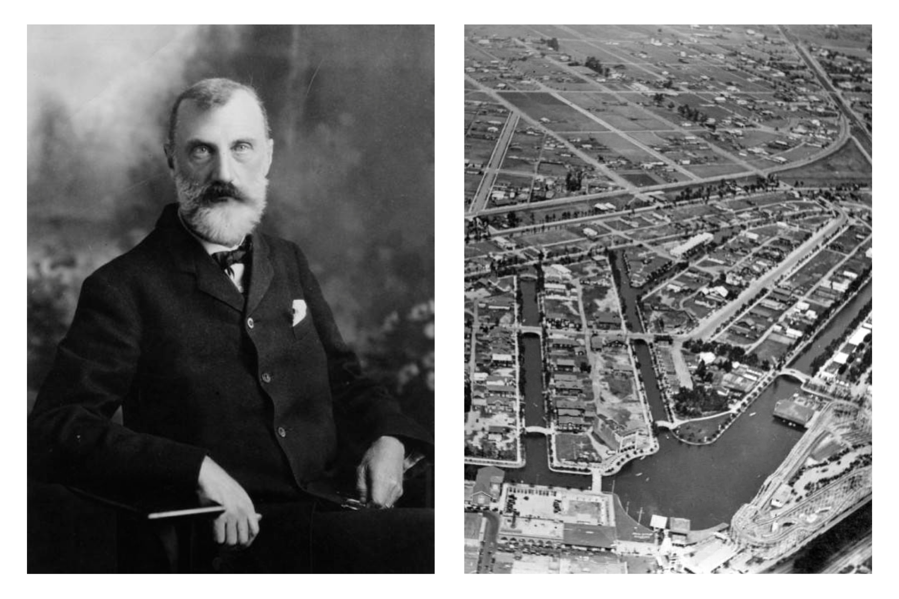
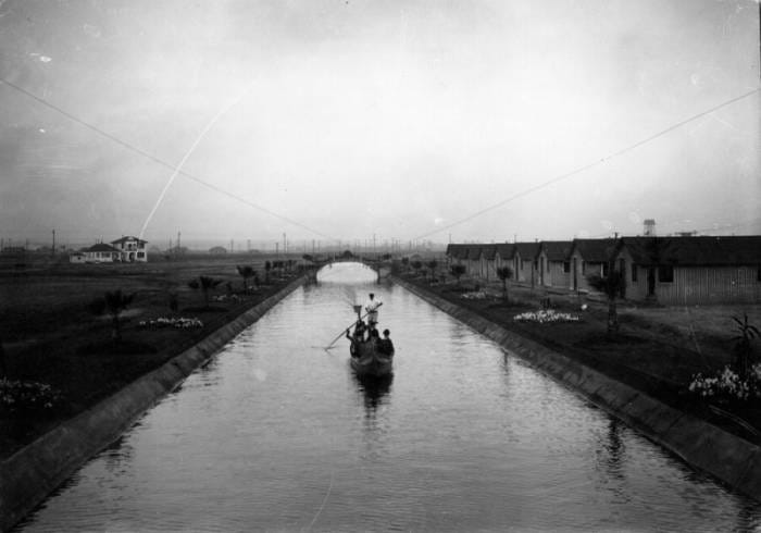
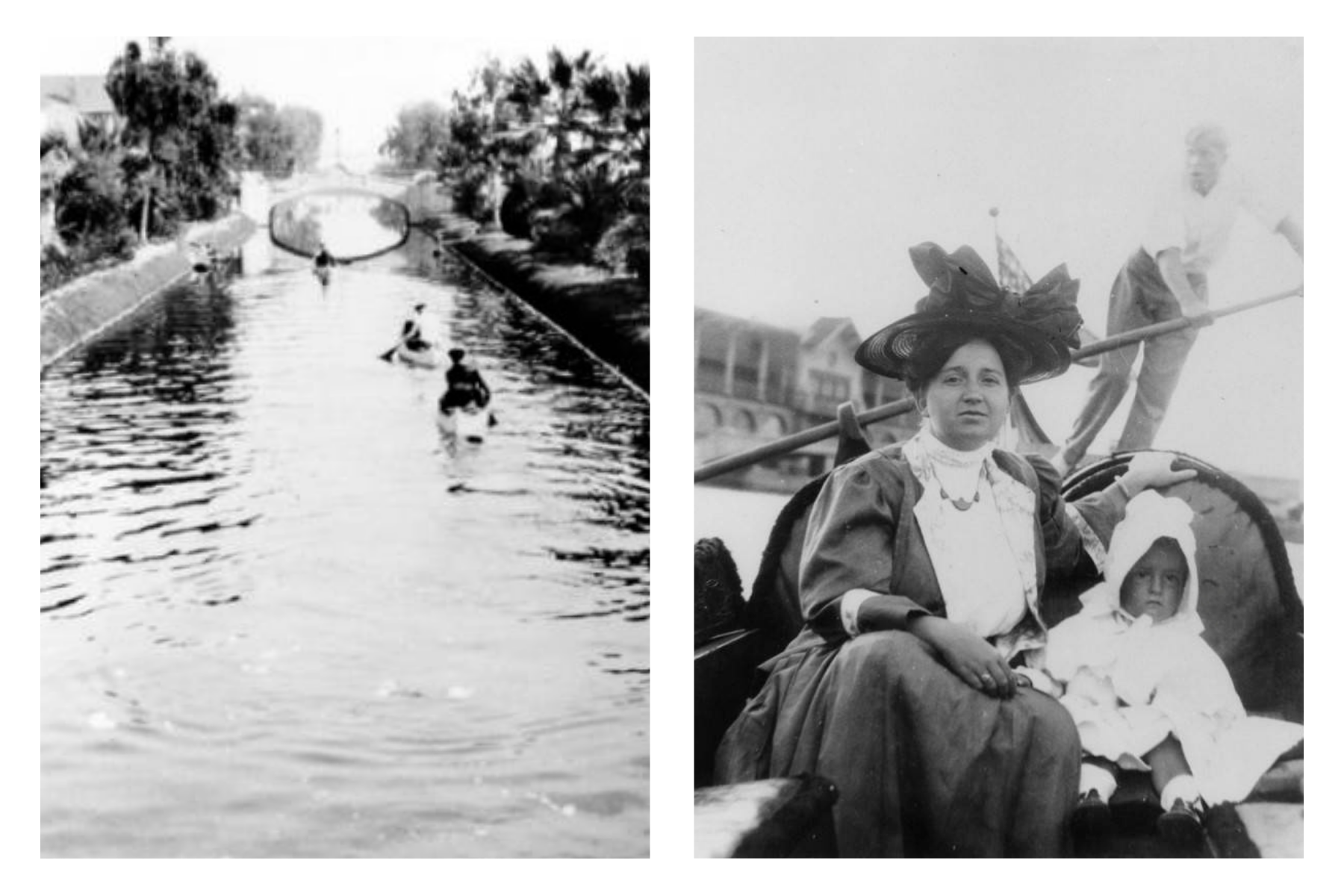
Kinney wanted a planned community modeled loosely on Venice, Italy: a place of canals, arcaded buildings, and classic Venetian gondoliers. The waterways were romantic, but they were also practical for development. Digging them helped drain and control land that could not otherwise be easily subdivided and sold.
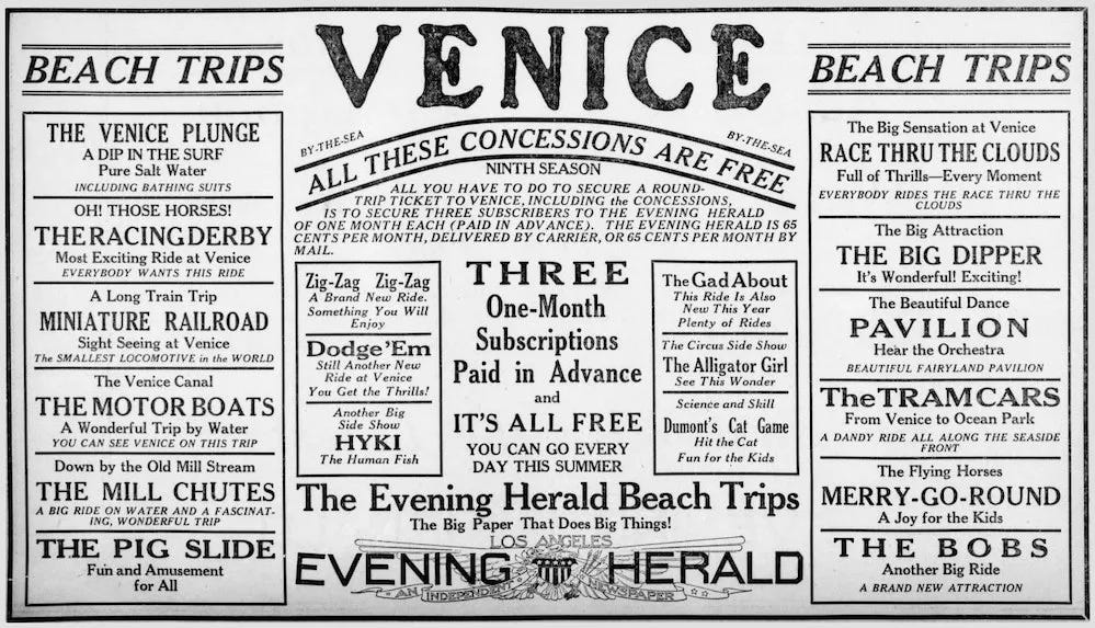
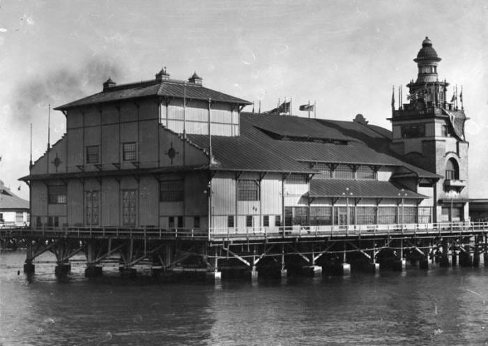
The plan included roughly two miles of canals arranged around a great Venetian Lagoon, with 504 residential lots — 289 of them facing the water. There would be a bathhouse, dance pavilion, casino, theater, hotels, and a pier extending into the Pacific from the commercial district at Windward Avenue.
Accessible by streetcar from Santa Monica and Los Angeles, “Venice of America” opened on July 4, 1905.
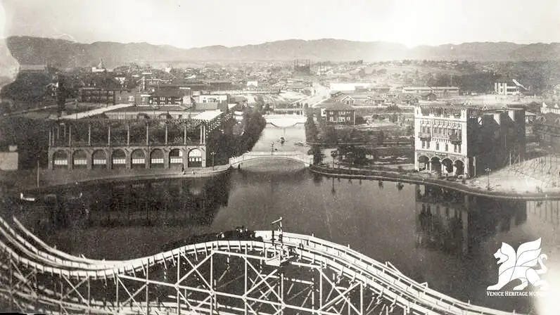
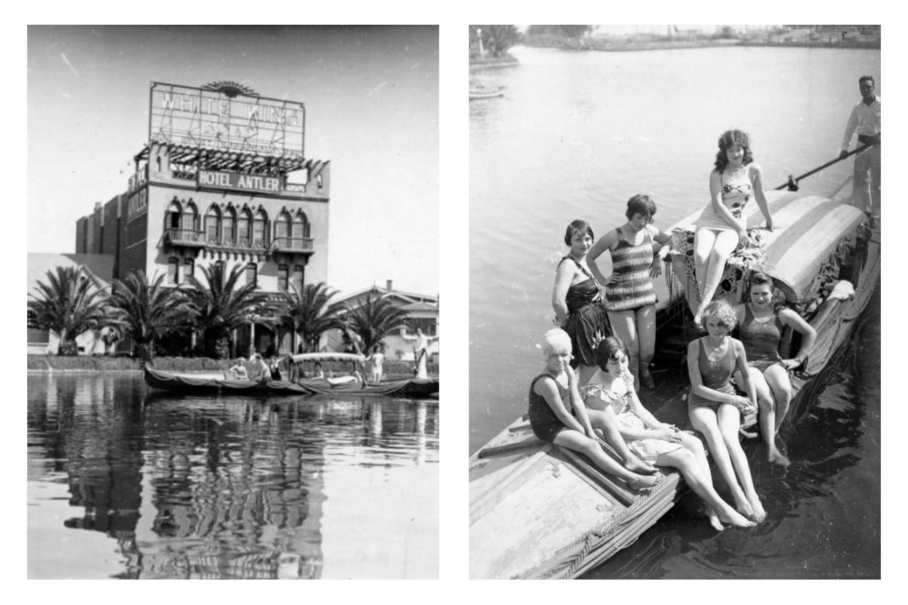
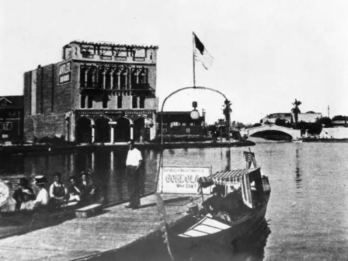
Visitors could arrive by electric railway, board a gondola, pass beneath a bridge, and travel through a new town that seemed to float between California and an imagined version of Italy. The canals made hard to develop land desirable. They also made it memorable.
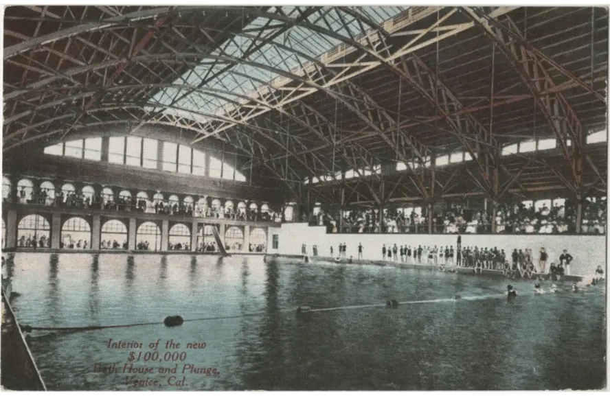
Attractions included everything from rides, to theatre and dance hall entertainment, to a no-longer-standing yet absolutely iconic heated saltwater bathhouse called The Venice Plunge. Built for today’s equivalent of about $4M, the bathhouse featured a 100-by-150-foot pool that allowed for heated Pacific swimming. The pool could hold two thousand swimmers and even had a unique plate-glass window replacing one wall so people outside could watch people swim. The bath house was opened in 1908 and closed down in 1943. Thirty-five years of heated Pacific bliss. Imagine the parties that S.P.A. would throw there today were it still standing.
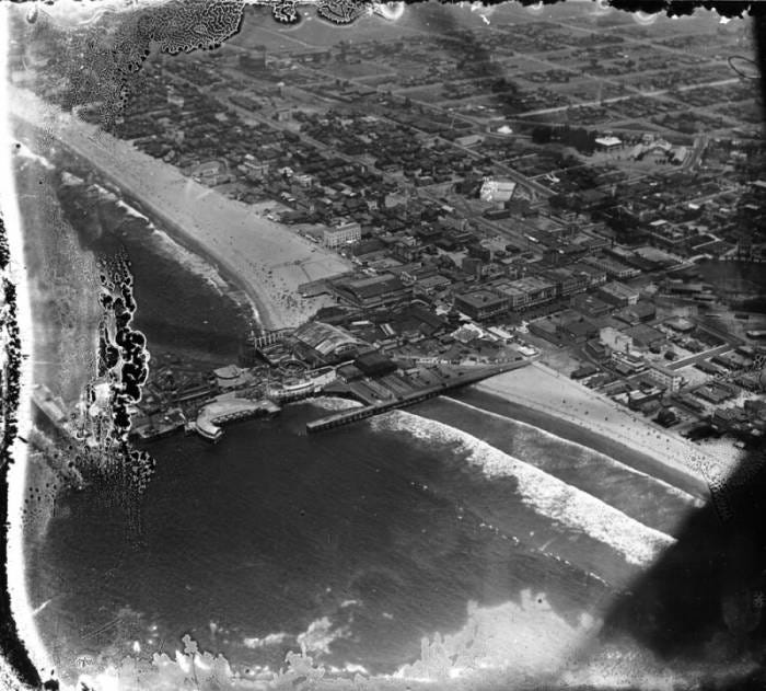
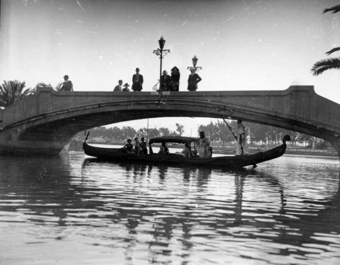
Venice continued growing after opening day. The residential population expanded, entertainment became increasingly central, and the infrastructure struggled to keep up. After Kinney died in 1920, conflicts intensified between tourist interests and permanent residents who wanted better services and a more governable city.
In 1925, after several bitterly contested elections, Venice was annexed by Los Angeles.
The annexation changed what the canals meant. Within a city increasingly organized around automobiles, the northern waterways began to look less like an amenity and more like an obstruction. After several earlier attempts, Los Angeles filled them with dirt and paved them in 1929.
The great lagoon became Windward Circle. Coral Canal became Main Street. Lion Canal became Windward Avenue. Grand Canal became Grand Boulevard. Water became roadway, but the unusual curves, diagonals, narrow parcels, and converging streets remained.
The city erased the water but kept their form. The remaining canals in Venice today are not, technically, the canals Kinney built.
As Kinney’s network was being excavated north of present-day Venice Boulevard, another group of property owners wanted waterways through their adjoining land to the south. The Ocean Park Improvement Association approved the idea in 1904, creating what became the Short Line Beach Venice Canal subdivision. Construction began in July 1905, only days after Kinney’s resort opened.
Four parallel canals—Carroll, Linnie, Howland, and Sherman—ran toward Grand Canal. Eastern Canal was added later. The system connected north to Kinney’s Venice of America and south through Ballona Lagoon toward Playa del Rey, allowing boats to travel from the amusement district toward the sea.
These are the waterways that remain. In other words, the most intact fragment of Kinney’s dream was not actually part of his original plan.
Though the southern canals escaped filling, their survival did not mean they were well cared for. Oil was discovered in Venice in 1929, and derricks appeared along the waterways farther south. Pollution entered the remaining canal system. Silt, debris, and stagnant water accumulated. Bridges and walkways decayed. By the time the Venice Canal Historic District was nominated to the National Register of Historic Places in 1982, the official description called its condition deteriorated.
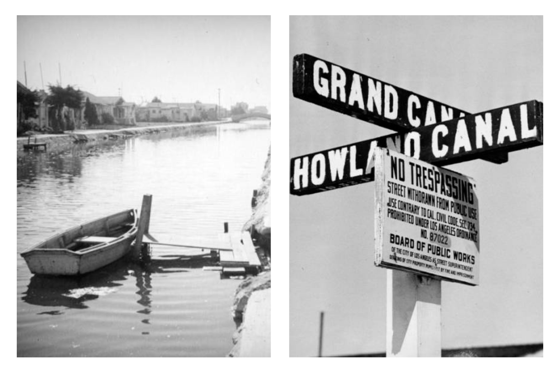
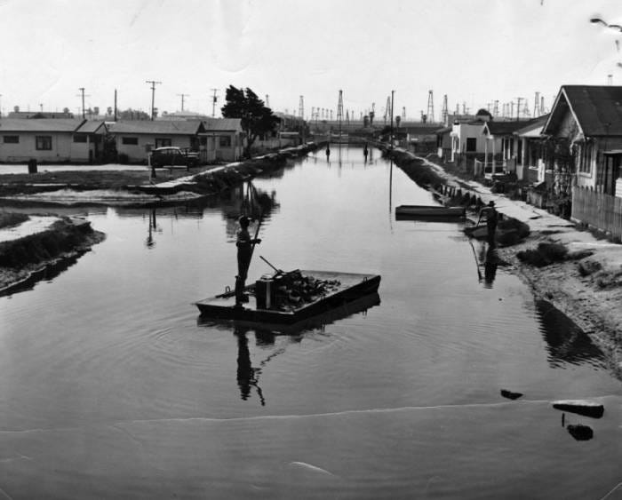
The nomination made an important distinction: it protected the canals and their public rights-of-way, not the surrounding houses.
The value of the canals highlighted the larger spatial idea and way of life: homes facing water instead of streets, pedestrian bridges connecting small islands, narrow walkways creating accidental encounters, and public infrastructure determining the rhythm of private life.
Residents were already asserting those values. From 1969 through 1976, annual canal festivals turned the threatened waterways into places of gathering and declaration. Preserving the canals was not only about saving a picturesque relic. It was about insisting that this alternative way of living still belonged in LA.
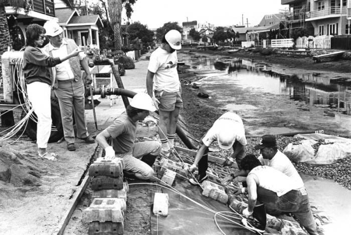
A major rehabilitation plan was approved in 1991 and completed in 1993. The canals were dredged. Banks and public walkways were rebuilt. Bridges were reconstructed. Vegetation was returned to the water’s edge, and circulation was improved.
Today, the canals remain connected to Ballona Lagoon and the ocean through a controlled tidal system. They are not simply decorative space between expensive houses; they are part of a living coastal environment — affected by runoff, water circulation, native planting, marine life, birds, and every decision made along their banks. Every time I’ve visited recently they have been nearly empty from drought.
Their history is therefore not a simple preservation story. The canals are artificial waterways carved into a much older wetland landscape. The six that survive were not Kinney’s originals but a neighboring extension. Their banks and bridges have been substantially rebuilt. Most of the surrounding houses arrived later.
And yet, the central relationship has endured: a way of life organized around water.
That may be the more useful definition of preservation: not freezing a place at the moment of its creation, but recognizing the relationship that makes it meaningful and prioritizing protecting that relationship.
At Windward Circle, traffic still moves around the shape of a vanished lagoon. On Carroll, Linnie, Howland, and Sherman, homes still turn away from the automobile and toward the water. Footbridges remain more direct than roads. Neighbors meet on narrow walk streets. The City of Los Angeles filled in the canals, but it never fully escaped their form. The water is gone. The geometry remembers.
As I explore more of Los Angeles history and learn more about historic preservation, I am struck by how much we’ve lost over the years. How the city we live in is a ghost of what it once was, how we trade soul for convenience, history for a promise of a better future.
Remembering is the only way we can ever preserve what we have now and return, in whatever small ways we can, to what once was.
Thank you to the Los Angeles Public Library and Venice Historical Museum for imagery.
Absolutely fascinating! Beautifully curated article.
YES!!! The bathing mega builds in LA were sooooo spectacular - we’ll have to trade old time photos soon 🩵